MAPS OF HELL
Find out exactly what hell offers before you go!
Title Text.
SYMBOL MAP
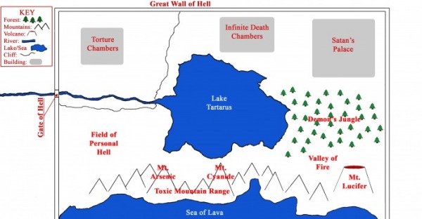
1 inch = 100,000 miles. The map above is 6 in x 4 in
Looks nice, right?
Sure, you keep thinking that. Just remember that this is a symbol map - it shows where things are but it's not reality. The real thing is pure hell.
ELEVATION MAP
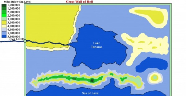
The highest Point is Mt. Cyanide at 1,000,000 miles beneath sea level. The majority of the land is at 5,000,000 miles beneath sea level.
CLIMATE MAP
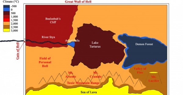
Most of hell is hot, though there are a few freezing places.
